Inspiration and information for new walks comes from many sources. Twitter has proved great recently for exchanging ideas with others (it does have a use!) but last weekend's inspiration came courtesy of a YouTube search for "West Pennines" and a user called "upforlastnameleft" who has uploaded a video called "My favourite walk".
Suitably inspired, and thinking that perhaps we'd avoid the crowded areas of Rivington and Anglezarke, we took a trip out to Yarrow last Sunday. Our route began on the dam between Upper Rivington and Anglezarke Reservoirs from where we headed on the signed track to the bowling club/cafe car park. The track does see some traffic from cars either going to the anglers car park or houses a mile or so away so it was dog on lead for a while here. The route was pleasant though, passing through trees until reaching a stile (lift required!) next to Dean Wood House.
From here we headed over the fields with views down to the water below. Crossing over another stile and another field we soon joined the road near Alance Bridge. A short stretch of quiet road walking followed before joining the obvious bridleway to complete our round trip. The start of this last stretch was a clear highlight,with great views through the trees to Anglezarke, as seen in the video. The dog was also able to run off lead on this stretch so it was a winner all round.
Given it was a busy Sunday it was incredibly quiet on this walk. Thanks very much to "upforlastnameleft"for sharing it with us.
Click here for google map
Doggy rating 6/10 (water everywhere but not a drop to swim in!)
Keep safe!

You are responsible for your own safety and that of your dog. The walks listed in this blog are not detailed guides. Plan your route! Click the landrover image for safety advice from Bowland Pennine MRT.
Friday, August 13, 2010
Saturday, August 07, 2010
Darwen Moor and Jubilee Tower
Torrential rain early this morning wasn't the best incentive to take a trip up on to the West Pennine Moors but having bought some new boots on Monday I was keen to give them a short try out. Despite the weather, or maybe because of it, the walk from Ryal Fold near Tockholes, up to Darwen Moor and around Jubilee Tower and the Reservoirs seemed ideal.
We parked as usual at the public car park next to the Cafe at Ryal Fold and took the footpath behind the cottages across the fields to the woods at Stepback Brook. We followed one of our usual routes alongside the Brook, gaining height quickly and climbing in to the low clouds covering Darwen Moor.

With no sheep around and the nesting season now over the dog was able to walk happily off the lead as we headed across the moorland. We had avoided the worst of the heavy rain and soon the clouds began to list. Passing "Ged's Seat" we stopped a while to watch the views over Lancashire slowly emerge, before heading in the direction of the Tower, which was then still obscured.

The clouds had just about risen above the top of the tower by the time we reached it but we never hang around at the Tower itself for too long. After a short climb to the first level we were soon heading down towards Sunnyhurst before joining the rough road past Earnsdale Reservoir. Despite the seemingly endless rain of recent weeks the reservoir remains surprisingly low, perhaps an indication of why the north west hosepipe ban remains in place.

Climbing up from the reservoir we were soon on the path through farm fields. One or two incredibly muddy farm gates later we arrived back at the car, wet and smelly but happy!
Click here for Google Map
Doggy rating 8/10. A great walk for August.
Friday, August 06, 2010
Elterwater to Skelwith Bridge (Cumbria)
My first trip to the Lake District was in the blisteringly hot summer of 1976. I thought it was perfectly normal to swim in lake Windermere, Stickle Tarn and the Upper Esk. I was proud that on one of the two less sunny days I remember that year we walked up in to the clouds high above Thirlmere and climbed Helvellyn. I'm pretty sure that "Helvellyn" was my first rucksack badge, proudly displayed as a reward for climbing in what at the time I thought were terrible weather conditions. Of course I've come to realise that cloud and rain on the lakeland peaks is perfectly normal...the innocence of youth!
I suspect most people not born in the Lakes remember their first days in the mountains. For me, one of the most special moments was walking in the evening from Elterwater Youth Hostel to the road leading to Chapel Stile. From there, we looked towards the seemingly distant Langdale Pikes and I was filled with awe when dad told me that we were to climb them the next day. The Pikes were my first lakeland peaks and I remember well the disappointment as we reached false summits, the excitement when the peak came clearly in to view and the feeling of triumph as I stood on top of the world.

Elterwater and the Langdale Pikes
For that reason and more, Elterwater holds special memories and will always be one of the most treasured places I visit. Happily, visits can be enjoyed without scaling the peaks. The walk from Elterwater to Skelwith Bridge is a gem and was as always the perfect day out with my visiting mum last Monday.
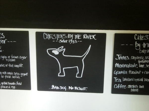
We began at the free NT car park in Elterwater and walked through the village to Great Langdale Beck. From here, the clearly signposted bridleway led us along the riverside and to the shores of Elterwater where we admired the stunning view over the lake towards the Pikes. Continuing over the meadows we soon heard the roar of Skelwith Force and again stood a while to watch the water crashing through the narrow gorge. A little further and the dog friendly terrace cafe at Chesters provided some light refreshment before returning on the opposite side of the river to the bridge above the Force and back to Elterwater.

Dogs welcome at Chesters by the River

Elterwater on a Winters Day
I suspect most people not born in the Lakes remember their first days in the mountains. For me, one of the most special moments was walking in the evening from Elterwater Youth Hostel to the road leading to Chapel Stile. From there, we looked towards the seemingly distant Langdale Pikes and I was filled with awe when dad told me that we were to climb them the next day. The Pikes were my first lakeland peaks and I remember well the disappointment as we reached false summits, the excitement when the peak came clearly in to view and the feeling of triumph as I stood on top of the world.

Elterwater and the Langdale Pikes
For that reason and more, Elterwater holds special memories and will always be one of the most treasured places I visit. Happily, visits can be enjoyed without scaling the peaks. The walk from Elterwater to Skelwith Bridge is a gem and was as always the perfect day out with my visiting mum last Monday.
We began at the free NT car park in Elterwater and walked through the village to Great Langdale Beck. From here, the clearly signposted bridleway led us along the riverside and to the shores of Elterwater where we admired the stunning view over the lake towards the Pikes. Continuing over the meadows we soon heard the roar of Skelwith Force and again stood a while to watch the water crashing through the narrow gorge. A little further and the dog friendly terrace cafe at Chesters provided some light refreshment before returning on the opposite side of the river to the bridge above the Force and back to Elterwater.

Dogs welcome at Chesters by the River
Much of the route is well surfaced although the autumn floods last year have taken their toll on stretches. It's easy walking though and most people should find this an easy but very rewarding short trip. At this time of year the route is busy with people and bikes so it was a dog on on-lead route for much of the way. The river did though provide him with some good opportunities for paddling and swimming and he was suitably shattered (and wet) when we arrived back at the car.

Elterwater on a Winters Day
Elterwater is a place we'll return to time and time again. It's a little piece of heaven. If you visit, please leave it as you find it.
Sunday, August 01, 2010
Along the Goit from White Coppice to Anglezarke
White Coppice, near Chorley, is one of our favourite start and end points for walks. From here you really are spoilt for choice in terms of walking routes, whether up on the moors to Great Hill, gentle footpaths to Healey Nab or along the banks of the Goit to Brinscall or Anglezarke. The completion of a new Bridleway, linking Brinscall and Anglezarke, opens up the options even further and makes what was already a great place to visit even better. I would never dream of calling my mum elderly (a young 80 something!) but with mum visiting for the weekend, today seemed like a good day to try out the new path, which makes the area far more accessible for those who can't walk quite as far as they used to!


Doggy rating 6/10. Great walk but lots of sheep

We began our walk today as usual walking past the white washed cottages and cricket pavilion before crossing the bridge over the Goit. Here, we took the waterside path right towards Anglezarke and enjoyed a mile or so of relatively flat walking below the steep slopes of Stronstrey Bank. The path along here is good but there are usually plenty of sheep grazing, so keep your dog on a lead.
On reaching the road at the end of Anglezarke Reservoir we turned left, following the road up the steep hill for 5 minutes or so until reaching the well signposted footpath through a kissing gate just before the farm at Siddow Fold. Walking through fields filled with grazing cattle, their calves and a (seemingly) placid bull was a little intimidating here, but we were soon walking down the hill with stunning views over the reservoir and beyond.

Passing through another (slightly awkward for an 80 something) kissing gate we turned right and along a fairly muddy path, made easier by the occasional duck boards, before rejoining the road at the end of Anglezarke. A few years on the other side of the bridge the new Goitway Bridleway led us back to our start at White Coppice. The Bridleway is a great addition to the extensive network of paths in the area, giving a great circular route of about 2.5 miles. The new path is well fenced but whilst your dog might be safe from livestock please respect the many other users of the path, including horseriders and mountain bikers, and keep your dog under close control.
Unfortunately the pavilion at White Coppice had shut by the time we returned so we had to pass on the obligatory ice cream. Fortunately, my better half had been busy whilst we were out, and we returned Cottage Pie followed by signature Banoffee Pie. The dog has now discovered that Cottage Pie fresh from the oven is hot and dogs who try to sneak a mouthful by jumping up at the table whilst their owners backs are turned will get a shock!
Click here for google map
Click here for information about the Giotway, a project which aims to open up currently inaccessible sections of the Goit and make existing stretches accessible to all
Doggy rating 6/10. Great walk but lots of sheep
Subscribe to:
Posts (Atom)


